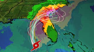

- Hurricane warning and storm surge warnings have been issued for parts of Florida.
- Tropical Storm Debby is expected to strengthen into a hurricane near the Florida Big Bend.
- Florida and the Southeast coast will see flooding rain from this system.
- Gusty winds, coastal flooding and a few tornadoes are also expected impacts.
Tropical Storm Debby is strengthening as it moves across the eastern Gulf of Mexico and is expected to become a hurricane before landfall in Florida’s Big Bend region Monday. Debby will then slow down and its legacy might instead be flooding across the Southeast.
Flooding rainfall, gusty winds and coastal flooding from this system will spread across the Florida Peninsula Sunday and then along the Southeast coast early in the coming week, where it could slow down or even stall, prolonging impacts.
(MAPS: Spaghetti Models And More)
Here’s where watches and warnings are in effect: A hurricane warning is now in effect for the Florida Gulf coast from the Suwannee River to the Ochlockonee River.
A hurricane watch is in effect west of the Ochlockonee River to Indian Pass and from east of the Suwannee River to Yankeetown. Tropical storm warnings and watches cover the rest of western Florida, from the Keys to north of Tampa Bay and the central Panhandle region. A tropical storm watch has also been issued for the Georgia coast from the mouth of St. Mary’s River to Altamaha Sound.
A storm surge warning has also been issued in the Florida Big Bend from Aripeka northward to the Indian Pass. A storm surge watch continues southward from that area to Bonita Beach and northward to Aripeka. This includes Tampa Bay and Charlotte Harbor. A storm surge watch has also been posted for the Georgia coast from the mouth of St. Mary’s River to Altamaha Sound. Life-threatening storm surge is possible in this area.


Tropical Storm And Hurricane Alerts
(A watch is issued when tropical storm conditions (39 to 73 mph sustained winds) or hurricane conditions (sustained winds of 74 mph or higher) are possible within 48 hours. A warning is issued when those conditions are expected within 36 hours.)
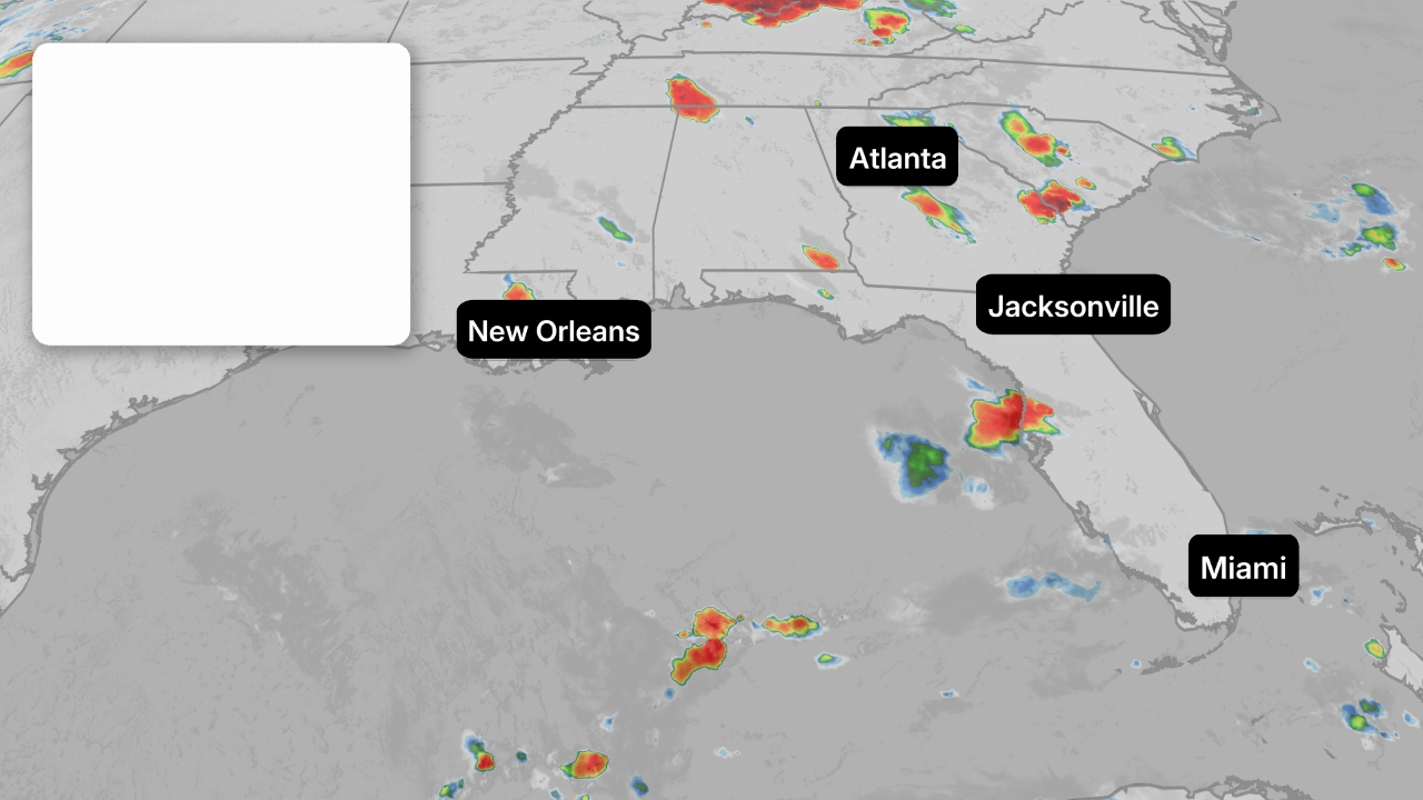
Here’s where the tropical storm is now. Tropical Storm Debby is currently centered west of southern Florida and is traveling north-northwestward. Some of its bands of rain are spreading across the Florida peninsula. A few thunderstorms have been severe.
Wind gusts have topped 45 mph throughout the Florida Keys at times since Saturday.


Here’s the latest projected path and intensity forecast. The latest National Hurricane Center forecast shows this system heading toward a landfall in Florida’s Big Bend region on Monday as a Category 1 hurricane, but they note that Debby could rapidly intensify over the warmest waters in all of the Atlantic Basin. It would be wise to prepare for a category higher than currently indicated.
It’s important to note that impacts from this system will be felt across much of the Florida Peninsula and well inland, and not just where the system makes landfall. Water is likely to have a bigger impact than the wind.
After reaching the Florida coast, Debby is forecast to track toward the Southeast coast by Tuesday or Wednesday, where it could intensify again, assuming it remains over water. There is an increasing possibility this system might slow down or even stall somewhere near the Southeast coast, which could prolong impacts, especially flooding rain.
(Further beef up your forecast with our detailed, hour-by-hour breakdown for the next 8 days – only available on our Premium Pro experience.)


Projected Path
(The red-shaded area denotes the potential path of the center of the system. It’s important to note that impacts (particularly heavy rain, high surf, coastal flooding, winds) with any tropical cyclone usually spread beyond its forecast path.)
Breaking Down The Impacts
Flooding Rainfall
The system will bring rainfall to Florida Sundat. Heavy rain could linger in Florida early in the week ahead while also spreading up through eastern Georgia and the eastern Carolinas. That means flash flooding and river flooding are possible in all of those areas. These bands of rain will bring heavy downpours and gusty winds.


Current Radar and Satellite
(The icon shows the current center of this system right now.)
As Debby slows down or stalls, it will prolong impacts near the Southeast coast and somewhat inland – particularly heavy rain. The slower a tropical system moves, the greater the rainfall. A study released last year by the NHC found rainfall flooding was responsible for the most direct U.S. deaths from tropical storms and hurricanes since 2013.
Rainfall totals of 6 to 12 inches (locally up 18 inches) are possible across parts of northern Florida this week. Rainfall totals of 10 to 20 inches is a concern in portions of southeast Georgia and South Carolina, with localized amounts up to 30 inches possible through Friday morning.
(For even more granular weather data tracking in your area, view your 15-minute details forecast in our Premium Pro experience.)


Rainfall Forecast
(This should be interpreted as a broad outlook of where the heaviest rain may fall. It could shift in future updates depending on how well organized this system becomes as well as its future track.)
Storm Surge
Coastal flooding from storm surge is possible on the western coast of Florida this weekend.
The surge could reach 6 to 10 feet above normal tide levels if the peak surge arrives at high tide in Florida’s Big Bend. Most other areas could see a storm surge of 2 to 6 feet, including Tampa Bay and Charlotte Harbor.
Eventually, coastal flooding could affect the Southeast coast early next week, with 2 to 4 feet currently expected for parts of the Georgia coast.


Wind And Tornado Threats
Much of the Florida Peninsula will see gusty winds at times this weekend, especially in heavier bands of rain. These winds will spread northward on Sunday. The times on the map below are indicative of when you should have all preparations complete.
Stronger wind gusts will cause power outages or tree damage, especially near and inland from where the eventual center of the system tracks.
The Southeast coast is likely to be affected by strong winds early in the week ahead. They will first arrive in northeast Florida by Monday morning, then slowly spread northward.


There is also the possibility of a few tornadoes in Florida Sunday and Monday. An isolated tornado is also possible early this week along the Georgia and South Carolina coasts.


Be sure to check back frequently to weather.com and The Weather Channel app for forecast updates in the days ahead.
MORE ON WEATHER.COM:
- Hurricane Season Peak Time Begins In August
- Why Slow-Moving Storms Are The Worst
- August US Outlook

