
The European Space Agency (ESA) has released new photos captured by the Mars Express satellite that show evidence of landslides and a turbulent past around the most imposing volcano in the Solar system: Olympus Mons.
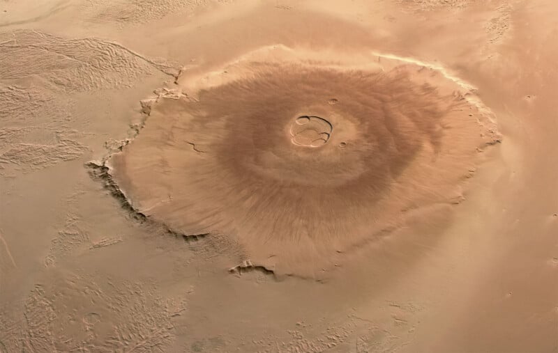
Mars is home to the largest volcanoes in the entire Solar System, and the tallest of these is Olympus Mons. Originally sighted by NASA’s Mariner 9, it is about 13.6 miles tall at its peak, which is about 2.5 times taller than Mount Everest when measured from sea level.
Above is an older photo of Olympus Mons as captured by the Mars Express (which has been in orbit around Mars since 2003), but it can be difficult to fully grasp its magnitude from such an image. As a sheer volcano, the slopes of Olympus Mons typically rise only a few degrees at a time and it is therefore spread across a truly gargantuan space — it covers an area greater than the entire Hawaiian volcano chain.
New photos of the area, including the Yelwa Crater and the much larger crater known as Lycus Sulci, not only provide details of how the region has changed over time but also provide a level of scale to how truly massive Olympus Mons is.
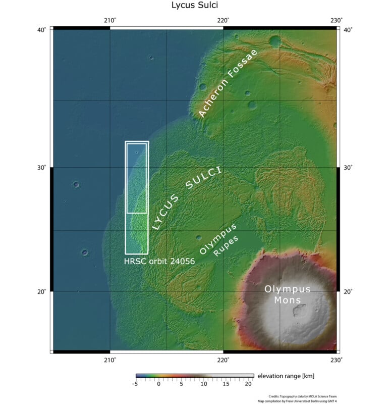
The colors of the terrain represent topography and elevation, ranging from lower blue areas through higher yellow-orange-reds to high peaks of white. The area outlined by the bold white rectangular box indicates the area imaged by the Mars Express High Resolution Stereo Camera on 18 January 2023 during orbit 24056. The smaller inset white box shows the region featured in these new Mars Express images. | NASA/MGS/MOLA Science Team
“[A] feature highlighting the truly immense proportions of Olympus Mons can be seen to the right of the frame in Yelwa Crater. Although dwarfed by the extensive Lycus Sulci, this crater is over 8 kilometers in diameter — just shy of Mount Everest’s elevation above sea level,” the ESA says.
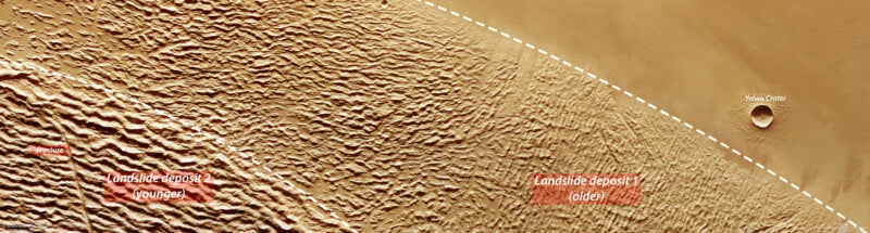
“Yelwa Crater is situated over 1,000 kilometers from the peak of Olympus Mons, demonstrating just how far the destructive landslides travelled from the volcano’s flanks before settling.”
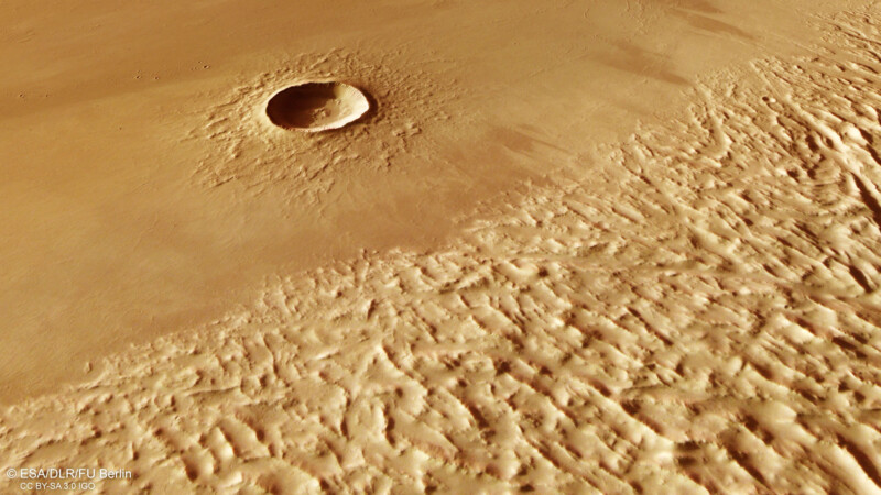
New views of the area give scientists a better idea of the history of this mammoth volcano and there is evidence that the lower flanks of Olympus Mons collapsed around 100 million years ago.
“Large amounts of lava once flowed down the volcano, triggering landslides that tumbled down its flanks to meet bedrock — in this case, bedrock containing ice and water,” the ESA explains.
“The swelteringly hot lava caused this ice to melt and become unstable; as a result, the rocky rim of Olympus Mons broke off and partially slid away. This collapse came in the form of huge rockfalls and landslides, which slipped downwards and spread widely across the surrounding plains.”

Over time as these landslides moved away from the volcano, they became compressed and stretched as they traveled across the surface, which is what is responsible for the patterns seen in the new images of the area.
What can be seen from these images shows that while there are obvious differences between the topography or Earth and Mars, how the volcanoes there have aged shows similarities. Comparable landslides, while certainly on a lesser scale, can be seen on volcanic islands like Hawaii and the Canary Islands.
These images were shot with the Mars Express’s HRSC, or High-Resolution Stereo Camera. This system is capable of imaging the entire planet in full color, 3D, and with a resolution of about 10 meters.