Bengaluru: Last month, India and the US released a joint statement following Prime Minister Narendra Modi’s official state visit, outlining among other things the collaborations the two nations intend to undertake, especially in national scientific programmes.
One of the points of action read: “The leaders celebrated the delivery of the NASA-ISRO Synthetic Aperture Radar (NISAR) satellite to ISRO’s U.R. Rao Satellite Centre in Bengaluru, India, and looked forward to NISAR’s 2024 launch from India.”
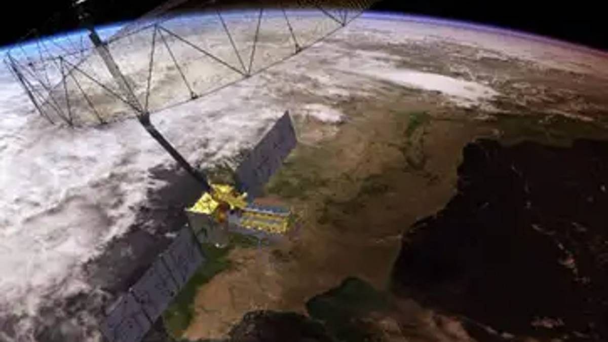
The NISAR satellite will use radar to map the Earth’s physical features, water bodies, and ice sheets, as well as study natural disasters like volcanism and landslides.
It will be launched from India and will contain two synthetic aperture radar systems on board, one built by the National Aeronautics and Space Administration (NASA) in the US and the other by the Indian Space Research Organisation (ISRO).
Once launched, the satellite is likely to be one of the most powerful Earth observation satellites, and also the most expensive earth-imaging satellites to date.
ThePrint explains what the NISAR mission is.
Also Read: Stellar crew of NASA’s Artemis moon voyage named & a possible ‘Himalayan’ error in glacier watch
What is NISAR?
The NISAR mission is a joint NASA-ISRO project to launch an Earth observation satellite with synthetic aperture radar.
It will be the first satellite ever to use dual frequencies — L-Band and S-Band — for radar imaging, and is likely to be the world’s most expensive earth-imaging satellite costing up to $1.5 billion, of which ISRO put in about $99 million (Rs 800 crore) and NASA $808 million, according to a reply given in the Rajya Sabha by the Department of Space in 2017.
The satellite is set to be launched aboard the GSLV in early 2024. It will orbit the Earth in a sun synchronous low-Earth orbit, where it passes over the same point on Earth at the same time each day.
ISRO states on its website that the satellite is expected to map all of the Earth in 12 days and provide geoscientific data about changes occurring on the planet due to natural disasters and climate change.
What is synthetic aperture radar?
A synthetic aperture radar is a kind of radar that produces two- or three-dimensional reconstructions of physical features on the Earth. It is always mounted on a moving vehicle such as an aircraft or satellite, and therefore produces a higher resolution image than a fixed radar antenna.
It moves in a sun-synchronous orbit because every point the satellite passes over has similar lighting and weather conditions on average as the previous day.
The NISAR mission is the first dual frequency radar-imaging mission in L-Band & S-Band, where the same areas are imaged in two different frequencies. It enables the radar to penetrate through tree canopy and also map sub-surface or underground features, according to ISRO.
The signals used in the two frequencies will characterise three Earth systems: ecosystems (vegetation and the carbon cycle), deformation (solid earth studies), and cryosphere sciences (climatic drivers and effects on sea level), ISRO states.
The radar systems will utilise the changes observed over time and space to discern data about large surface climate processes and natural disasters, and will provide especially accurate data about vegetation and underground water.
The SAR is said to be so precise that even a few millimetres of deformation or change on land surface will be mappable.
What are the objectives?
The stated purpose of the NISAR mission is to make radar observations to understand the natural processes involved in climate change, such as sea level rise and ice-sheet loss, as well as natural disasters like earthquakes and tsunamis.
This will enable better hazard monitoring and better emergency preparedness, as well as inform policies around climate change.
The satellite will also acquire information about sea-level rise, shoreline erosion, and other kinds of data along Indian coasts. Additionally, it will help in gathering data about Antarctic sea ice around India’s South Pole stations.
The satellite has a 12-metre-wide deployable mesh reflector that is mounted on a NASA-developed 9-metre-long boom or long arm with hinges. While the NASA-Jet Propulsion Laboratory developed the L-band payload system, the ISRO developed the S-band system.
Development of the payloads and structure is occurring simultaneously at ISRO and NASA centres in India and the US.
(Edited by Nida Fatima Siddiqui)
Also Read: Mars could have been watery world 400,000 yrs ago — Chinese rover finds signs of water activity

