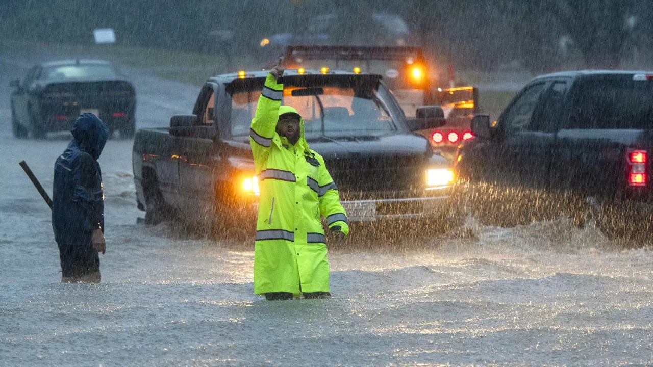
PORTLAND: Storm Lee hurtled across the Atlantic on Saturday, threatening millions of people in coastal New England and eastern Canada with hurricane-force winds, dangerous surf and torrential rains.
Severe conditions were predicted across parts of Massachusetts and Maine, and hurricane conditions could hit the Canadian provinces of New Brunswick and Nova Scotia, where the storm, downgraded early Saturday from hurricane to post-tropical cyclone, was expected to make landfall later in the day.
The storm’s center was about 185 miles (365 kilometers) southwest of Halifax, Nova Scotia, and about 160 miles (355 kilometers) south-southeast of Eastport, Maine, at 8 a.m. EDT Saturday. It was moving north at a fast clip of 25 mph (41 kph), with maximum sustained winds of 80 mph (129 kph).
Hurricane watches were in effect for New Brunswick and Nova Scotia, while a tropical storm warning stretched from Westport, Massachusetts, to Nova Scotia.
States of emergency were declared for Massachusetts and Maine, the nation’s most heavily forested state, where the ground was saturated and trees were weakened by heavy summer rains.
Utilities reported tens of thousands of customers without power from Maine to Nova Scotia.
There were reports of trees down in eastern Maine, according to Todd Foisy, a National Weather Service meteorologist.
“We have a long way to go, and we’re already seeing downed trees and power outages,” Foisy said Saturday.
Peak gusts are projected to be 70 mph (113 kph) on the coast in eastern Maine, but there will be gusts up to 50 mph (80 kph) across a swath more than 400 miles wide, from Maine’s Moosehead Lake eastward all the way into the ocean, he said.
Cruise ships found refuge at berths in Portland, while lobstermen in Bar Harbor, Maine, and elsewhere pulled their costly traps from the water and hauled their boats inland, leaving some harbors looking like ghost towns on Friday.
Lee already lashed the US Virgin Islands, the Bahamas and Bermuda before turning northward, and heavy swells were likely to cause “life-threatening surf and rip current conditions” in the UUSS. and Canada, according to the hurricane center.
Parts of coastal Maine could see waves up to 15 feet (4.5 meters) high crashing down, causing erosion and damage, and the strong gusts will cause power outages, said Louise Fode, a National Weather Service meteorologist. As much as 5 inches (12 centimeters) of rain was forecast for eastern Maine, where a flash flood watch was in effect.
But even as they prepared, New Englanders seemed largely unconcerned. In Maine, where people are accustomed to damaging winter nor’easters, some brushed aside the coming Lee as something akin to those storms, only without the snow.
“There’s going to be huge white rollers coming in on top of 50- to 60-mph winds. It’ll be quite entertaining,” Bar Harbor lobsterman Bruce Young said Friday. Still, he had his boat moved to the local airport, saying it’s better to be safe than sorry.
On Long Island, commercial lobsterman Steve Train finished hauling 200 traps out of the water on Friday. Train, who is also a firefighter, was going to wait out the storm on the island in Casco Bay.
He was not concerned about staying there in the storm. “Not one bit,” he said.
In Canada, Ian Hubbard, a meteorologist for Environment and Climate Change Canada and the Canadian Hurricane Centre, said Lee won’t be anywhere near as severe as the remnants of Hurricane Fiona, which a year ago washed houses into the ocean, knocked out power to most of two provinces and swept a woman into the sea.
But it was still a dangerous storm. Kyle Leavitt, director of the New Brunswick Emergency Management Organization, urged residents to stay home, saying, “Nothing good can come from checking out the big waves and how strong the wind truly is.”
Destructive hurricanes are relatively rare this far to the north. The Great New England Hurricane of 1938 brought gusts as high as 186 mph (300 kph) and sustained winds of 121 mph (195 kph) at Massachusetts’ Blue Hill Observatory. But there have been no storms that powerful in recent years.
The region learned the hard way with Hurricane Irene in 2011 that damage isn’t always confined to the coast. Downgraded to a tropical storm, Irene still caused more than $800 million in damage in Vermont.
Denial of responsibility! Swift Telecast is an automatic aggregator of the all world’s media. In each content, the hyperlink to the primary source is specified. All trademarks belong to their rightful owners, all materials to their authors. If you are the owner of the content and do not want us to publish your materials, please contact us by email – swifttelecast.com. The content will be deleted within 24 hours.


