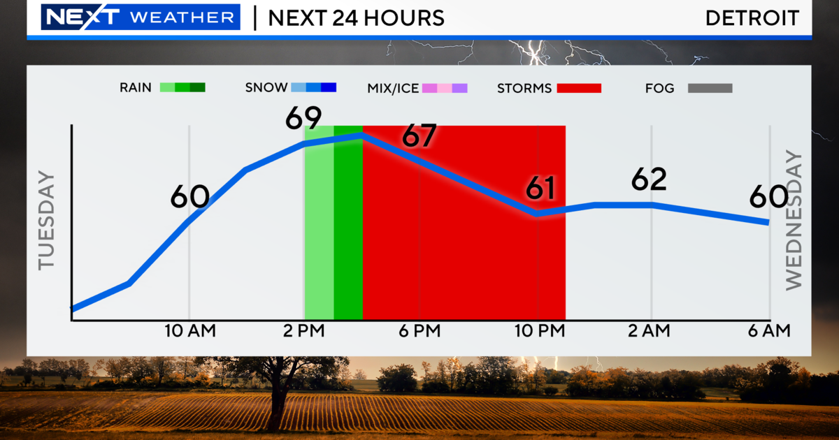
(CBS DETROIT) – Tuesday will start out full of sunshine, as temperatures will begin the day in the upper 40s and low 50s. Clouds will begin to filter in in the afternoon as a warm front connected to a low-pressure system pushes through, bringing a chance of showers and storms while temperatures reach into the low 70s.
There is a potential that some storms may become strong to severe, mainly south of a line from Midland to Port Huron. This area of Southeast Michigan will have a marginal risk for severe storms, or a category 1 out of 5 storm risk. A line from Lansing to Ann Arbor to just south of Detroit and counties south are under a slight, or category 2 out of 5, severe storm risk.

NEXT Weather/CBS Detroit
The biggest threat with this storm system will be winds gusting to 60 miles per hour, large hail around 1 inch in diameter, heavy rainfall within the storms, and an isolated tornado that cannot be ruled out. While showers and storms are possible through the afternoon and evening, strong or severe storms will most likely occur between 3 p.m. and 9 p.m.

NEXT Weather/CBS Detroit
For your latest NEXT Weather forecast, watch on air on CBS Detroit, online on CBSDetroit.com, or streaming on the CBS Detroit app, Paramount+, or PlutoTV.
