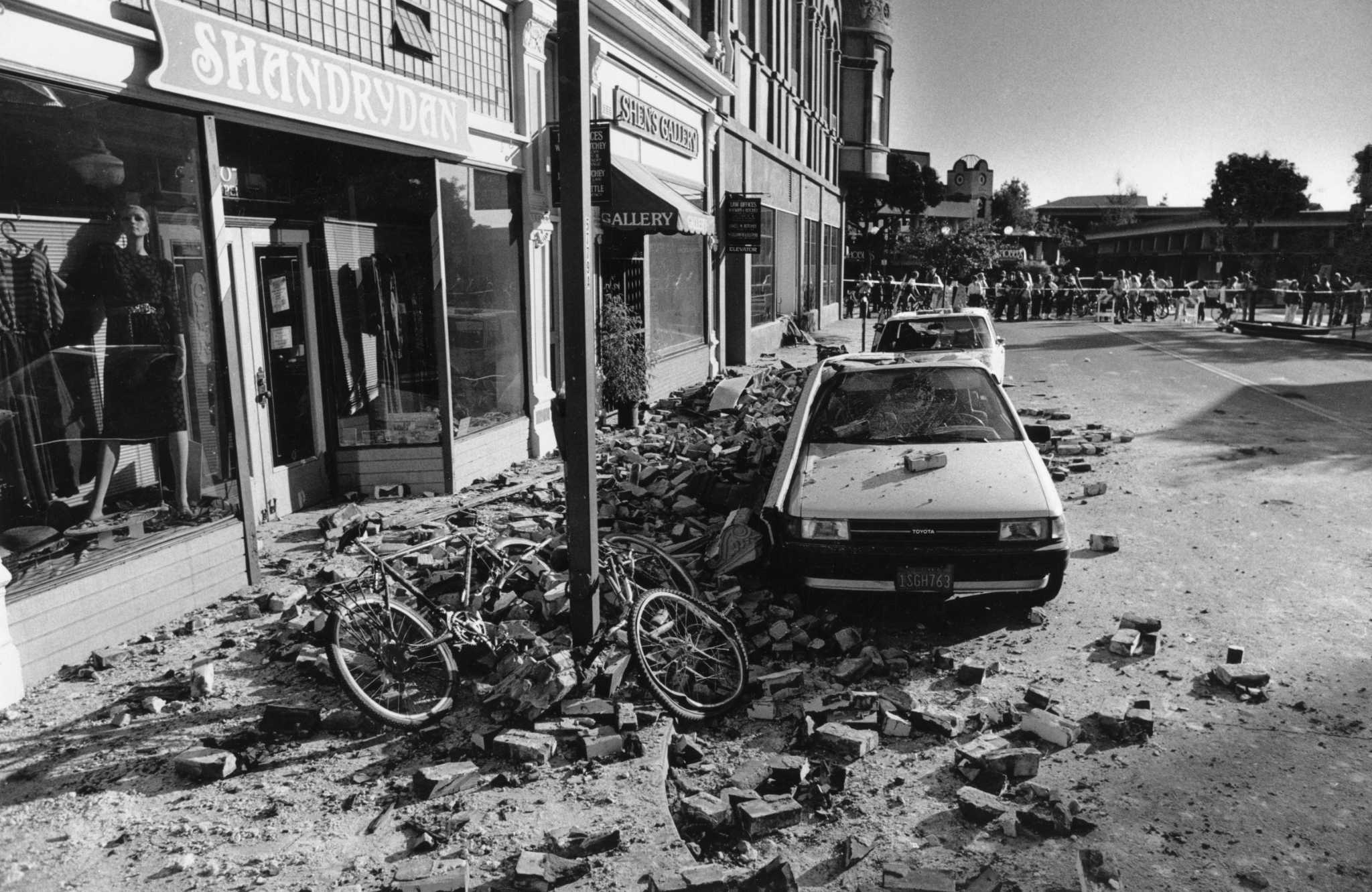
Downtown Santa Cruz was severely damaged by the 6.9-magnitude Loma Prieta earthquake in October 1989.
Steve Castillo/The ChronicleAn updated U.S. earthquake model showed slightly greater shaking possible in California than previously mapped.
The National Seismic Hazard Model, developed by the United States Geological Survey, says that most of California has at least a 75% chance of damaging earthquake shaking in the next 100 years — with at least a 95% chance for the Bay Area.
Article continues below this ad
“Across California, the hazard has increased a little. It’s not an alarming level of increase but it’s something that helps us to understand more of the details of where shaking will be higher,” said Mark Petersen, USGS geophysicist and lead author of the study.
The study measured the probability of experiencing a damaging earthquake taking into account magnitude, distance from the epicenter and likelihood of an earthquake, according to USGS research geophysicist Kevin Milner.
Compared with the prior model, done in 2018, California locations had about a 10% or less increase in the chances of experiencing a damaging earthquake, Milner said. The new data also marks the chances of a 7.0 magnitude earthquake in the Bay Area at a given time being 3% greater than noted in 2018 and 80% greater statewide, he said.
Petersen said the forecast earthquake hazards for the Bay Area have always been high and continue to be.
Article continues below this ad
In the state, the highest chances for damaging earthquake shaking is along the coast, according to the model, published in January. Across all states, California also has the highest risk for damaging earthquakes.
The model was created as a tool for people, including engineers and policymakers, to mitigate the risks of earthquakes.
“California has earthquakes. We already knew that. But what we want to know is in detail how can we better design buildings and bridges and develop communities that are resilient and can recover quickly from earthquakes?” Petersen said.
The findings can be applied to building codes to ensure structures can withstand the kind of shaking possible at a certain location, Petersen said.
About 500 new faults were mapped in the model, but few of those faults were in California. Most were in other western states, which did not have as extensive fault databases as California, Petersen said.
Article continues below this ad
“The improvement in California was to think about what kinds of earthquakes you can have on the known faults we already have recognized in California,” he said.
One of the areas of improved research was the types of earthquake ruptures possible. Petersen said earthquakes have complex rupture patterns — sometimes they break at an individual part of a fault or many faults can break together, creating larger earthquakes.
The new model takes into account the possibility of these multi-segment fault ruptures more so than previous models.
“We try to simulate what kinds of ruptures we will see based on the geometry of the faults, the slip rates of the faults and the continuity of the faults,” Petersen said. “In this new model we have accounted for many more of the complexities and alternative types of ruptures that we think can happen but hadn’t considered in the past.”
In addition to improving the modeling on fault ruptures, the new model takes into account how the rocks and soil can impact the amount of shaking.
Article continues below this ad
“In several areas of the San Francisco Bay Area and Los Angeles area, we had previously included some estimates of amplifications from these sediments beneath our feet. In this model we have expanded on that,” Petersen said.
Sandy soils and some clay material have the potential to intensify shaking, Peterson said. This happened in the 1989 Loma Prieta earthquake, he said.
“In the Marina District for example, we had a lot of sandy soils that amplified the shaking and caused damage but also caused liquefaction,” Petersen said.
Within California, only the sediment in the San Francisco area, Los Angeles area and Central Valley were accounted for in the new model, Petersen said. So there is more work needed to expand that research across the state.
“As we try and understand more about the Earth, we recognize that there’s a lot more to learn and that we need to continue to study,” Petersen said.
Article continues below this ad
Reach Clare Fonstein: clare.fonstein@sfchronicle.com