New Delhi: In a first, Survey of India, the national mapping agency under the department of science & technology, Government of India, is collaborating with Mumbai-based company Genesys International to create high-resolution 3D digital maps of India.
Under the initiative, “digital twin cities” will be created to provide insight into urban planning and development, navigation, disaster resilience and other things.
A Memorandum of Understanding (MoU) — the first with a private company in India since the Modi government announced its National Geospatial Policy last year — has been signed for the same.
Genesys International, the mapping company that brought ‘Street View’ to Google Maps for India, will be using its established arsenal of drones and aircraft to create detailed 3D maps of major cities.
Survey of India’s network of Continuously Operating Reference Stations (CORS) — comprising more than 1,000 GPS reference stations — will provide high-quality positioning infrastructure to complement the data collected by Genesys.
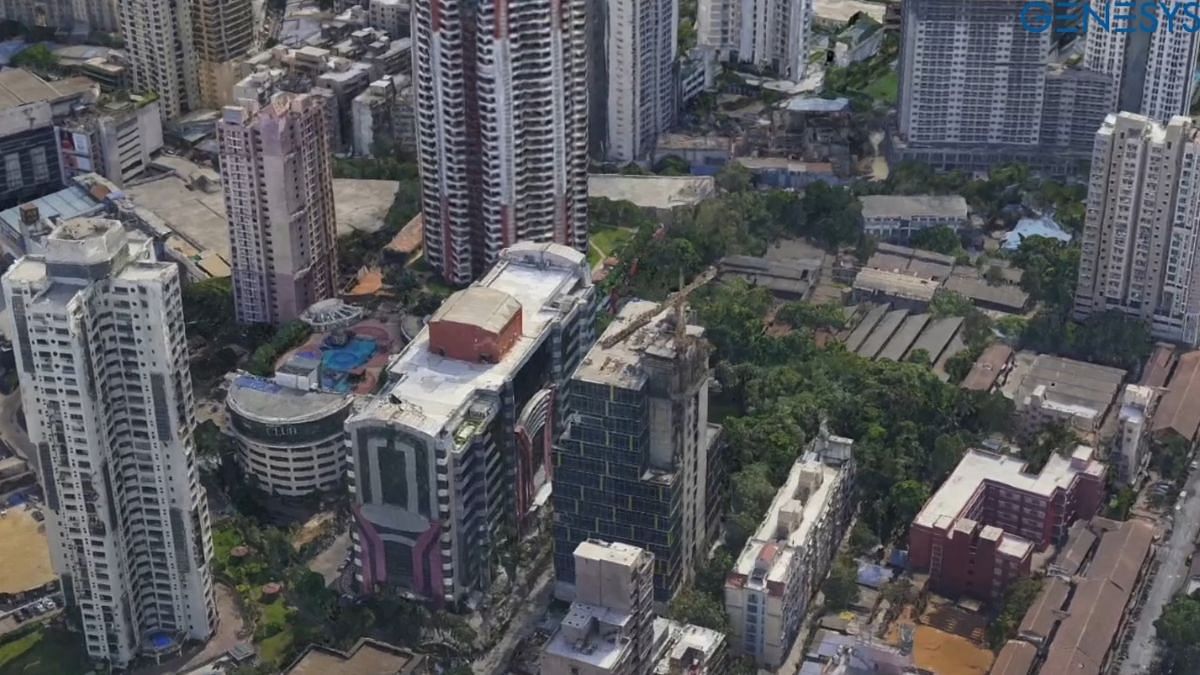
The 3D digital twin cities will mirror the real urban landscape, reproducing buildings, roads, topography and the green cover.
At a press event in New Delhi Wednesday, Genesys International demonstrated what these maps could be utilised for.
Taking Kochi as an example, Sajid Malik, Managing Director of the company, said the digital maps could help model which areas may be vulnerable to flooding after extreme rainfall events. Similarly, the digital maps could be used to optimise the position of telecom towers — to see if they have any obstructions in their line of view.
The maps could even be used to see how much sunlight every rooftop in a city receives to check the viability of investing in rooftop solar panels, he explained.
“So far, the government used to look at mapping only from the lens of security. But they have now realised how much value these (mapping) services can be of,” Malik told ThePrint on the sidelines of the event.
“For example, Google Maps right now can tell you how to get from point A to point B — but smart cars will need more information than that. That is where dynamic digital mapping can come handy.”
Malik pointed out that currently there was no way to know how disaster-prone a building in an area was. “It is only when disaster strikes that we get to know,” he said.
The digital twin cities have the potential to usher in a new set of compliance requirements for real estate developers, he added.
With the digital twin cities, for example, a digital replica of an intended building can be placed to virtually model how it would be affected by natural disasters.
“The 3D digital twin we aim to create will be a valuable asset for various government initiatives,” Hitesh Kumar S. Makwana, the newly-appointed Surveyor General of India, said at the event.
“The integration of our CORS technology with Genesys’ mapping expertise will elevate the accuracy and reliability of geospatial data, unlocking new possibilities for India’s development.”
Makwana told ThePrint that he hoped this was the first of many such government partnerships with private companies in the future.
Asked about data security and privacy concerns associated with private players handling such data, Makwana said, “We are in consultation with various stakeholders to safeguard data and resolve security concerns.”
Genesys has already created 3D twins of areas like Mumbai’s Dharavi — where surveys were conducted on foot — as well as Worli. Other cities that have been mapped include Jaipur, Kochi, Ayodhya and Surat.
Genesys will now licence its geospatial data products to end users. It will also join efforts to apprise city administrations of the utility of accurate geospatial datasets by conducting technical workshops.
(Edited by Nida Fatima Siddiqui)
Also Read: 5 maps that tell you all you want to know about India vs China in Ladakh